
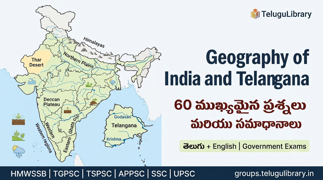
Introduction
Geography of India and Telangana is an important topic for HMWSSB, TGPSC, TSPSC, APPSC, SSC and other government examinations.
ఈ postలో India మరియు Telangana Geographyకి సంబంధించిన ముఖ్యమైన concepts, physical features, rivers, climate, soils, agriculture, minerals, population, Telangana geographical features మరియు important exam facts గురించి 60 ముఖ్యమైన ప్రశ్నలు మరియు సమాధానాలు ఇచ్చాము.
ఈ questionsను తెలుగు + Englishలో సులభంగా అర్థమయ్యే విధంగా రూపొందించాము.
1. Geography of India – Basic Concepts
1. భారతదేశం ఏ ఖండంలో ఉంది?
జవాబు: భారతదేశం Asia ఖండంలో ఉంది. ఇది South Asiaలోని ప్రధాన దేశాలలో ఒకటి.
2. భారతదేశం ఏ అర్ధగోళాలలో ఉంది?
జవాబు: భారతదేశం Northern Hemisphere మరియు Eastern Hemisphereలో ఉంది.
3. భారతదేశ ప్రధాన భూభాగం సుమారుగా ఏ అక్షాంశాల మధ్య విస్తరించి ఉంది?
జవాబు: భారత ప్రధాన భూభాగం సుమారుగా 8°4′ N నుండి 37°6′ N అక్షాంశాల మధ్య విస్తరించి ఉంది.
4. భారతదేశం సుమారుగా ఏ రేఖాంశాల మధ్య విస్తరించి ఉంది?
జవాబు: భారతదేశం సుమారుగా 68°7′ E నుండి 97°25′ E రేఖాంశాల మధ్య విస్తరించి ఉంది.
5. భారత Standard Meridian ఏమిటి?
జవాబు: భారతదేశ Standard Meridian 82°30′ E longitude.
6. భారత Standard Meridian ఏ ప్రాంతం సమీపంలో గుండా వెళుతుంది?
జవాబు: Mirzapur, Uttar Pradesh సమీపంలో 82°30′ E longitude గుండా భారత Standard Meridian వెళుతుంది.
7. భారతదేశ భౌగోళిక వైవిధ్యానికి ప్రధాన కారణం ఏమిటి?
జవాబు: భారతదేశంలో mountains, plains, plateaus, deserts, coastal plains మరియు islands వంటి విభిన్న physical features ఉండటం వల్ల భౌగోళిక వైవిధ్యం ఎక్కువగా ఉంటుంది.
8. భారతదేశ Physical Features ప్రధానంగా ఎన్ని విభాగాలుగా విభజించబడతాయి?
జవాబు: సాధారణంగా భారతదేశ భౌతిక స్వరూపాన్ని 6 ప్రధాన physiographic divisionsగా విభజిస్తారు:
- Himalayan Mountains
- Northern Plains
- Peninsular Plateau
- Indian Desert
- Coastal Plains
- Islands
ఈ classification NCERT Geographyలో కూడా ఉపయోగించబడుతుంది.
2. Physical Features of India
9. Himalayas ఏ రకమైన పర్వతాలు?
జవాబు: Himalayas young fold mountains.
10. Himalayas భారతదేశంలోని ఏ దిశలో ఉన్నాయి?
జవాబు: Himalayas భారతదేశానికి ఉత్తర సరిహద్దులో విస్తరించి ఉన్నాయి.
11. Himalayasలో అత్యంత ఉత్తరాన ఉన్న ప్రధాన శ్రేణి ఏది?
జవాబు: Himadri లేదా Greater Himalayas.
12. Northern Plains ఎలా ఏర్పడ్డాయి?
జవాబు: Indus, Ganga, Brahmaputra మరియు వాటి tributaries తీసుకువచ్చిన alluvial deposits వల్ల Northern Plains ఏర్పడ్డాయి.
13. Peninsular Plateau ప్రత్యేకత ఏమిటి?
జవాబు: Peninsular Plateau భారతదేశంలోని అత్యంత పురాతన భూభాగాలలో ఒకటి. ఇది ప్రధానంగా ancient crystalline rocksతో ఏర్పడింది.
14. Deccan Plateau అంటే ఏమిటి?
జవాబు: Peninsular Plateauలోని ప్రధాన భాగాలలో Deccan Plateau ఒకటి. ఇది ప్రధానంగా భారతదేశ దక్షిణ భాగంలో విస్తరించి ఉంది.
15. Indian Desertను సాధారణంగా ఏ పేరుతో పిలుస్తారు?
జవాబు: Thar Desert లేదా Great Indian Desert.
16. భారతదేశ పశ్చిమ తీర ప్రాంతాన్ని ఏమంటారు?
జవాబు: Western Coastal Plains.
17. భారతదేశ తూర్పు తీర ప్రాంతాన్ని ఏమంటారు?
జవాబు: Eastern Coastal Plains.
18. భారతదేశంలోని ప్రధాన ద్వీప సమూహాలు ఏవి?
జవాబు: Andaman and Nicobar Islands మరియు Lakshadweep.
3. Rivers and Drainage System
19. భారతదేశ నదులను ప్రధానంగా ఎన్ని drainage systemsగా చూడవచ్చు?
జవాబు: ప్రధానంగా Himalayan drainage system మరియు Peninsular drainage systemగా విభజిస్తారు.
20. Himalayan riversకి ప్రధాన లక్షణం ఏమిటి?
జవాబు: Himalayan riversలో చాలావరకు snowmelt మరియు rainfall రెండింటి ద్వారా నీరు లభిస్తుంది. అందువల్ల అనేక నదులు సంవత్సరంలో ఎక్కువ కాలం ప్రవహిస్తాయి.
21. Peninsular riversకి సాధారణ లక్షణం ఏమిటి?
జవాబు: Peninsular rivers ఎక్కువగా rainfallపై ఆధారపడి ఉంటాయి. వాటి ప్రవాహం seasonal variationకు లోబడి ఉంటుంది.
22. భారతదేశంలో ప్రధాన Himalayan rivers ఏవి?
జవాబు: Indus, Ganga మరియు Brahmaputra ప్రధాన Himalayan river systems.
23. Ganga నది ప్రధాన ఉపనదులు ఏవి?
జవాబు: Yamuna, Ghaghara, Gandak, Kosi వంటి నదులు Gangaకు ముఖ్యమైన tributaries.
24. Peninsular Indiaలో ముఖ్యమైన తూర్పు దిశగా ప్రవహించే నదులు ఏవి?
జవాబు: Mahanadi, Godavari, Krishna మరియు Kaveri ముఖ్యమైన east-flowing rivers.
25. Narmada మరియు Tapi నదుల ప్రత్యేకత ఏమిటి?
జవాబు: ఇవి ముఖ్యమైన west-flowing peninsular rivers. ఇవి Arabian Sea వైపు ప్రవహిస్తాయి.
4. Climate of India
26. భారతదేశ వాతావరణాన్ని ప్రధానంగా ఏ రకమైన climateగా పరిగణిస్తారు?
జవాబు: భారతదేశంలో ప్రధానంగా Monsoon type of climate ఉంటుంది.
27. Indian Monsoon అంటే ఏమిటి?
జవాబు: ఋతువుల ప్రకారం గాలుల దిశలో జరిగే seasonal reversalను సాధారణంగా Monsoon అంటారు.
28. భారతదేశానికి అత్యంత ముఖ్యమైన వర్షాకాల గాలి ఏది?
జవాబు: Southwest Monsoon భారతదేశ వర్షపాతంలో ముఖ్యమైన పాత్ర పోషిస్తుంది.
29. Southwest Monsoon సాధారణంగా భారతదేశానికి ఎప్పుడు చేరుతుంది?
జవాబు: సాధారణంగా Southwest Monsoon Juneలో భారతదేశంలోకి ప్రవేశిస్తుంది.
30. భారతదేశ వర్షపాతంపై Monsoon ఎందుకు ముఖ్యమైనది?
జవాబు: వ్యవసాయం, నీటి వనరులు, reservoirs, groundwater recharge మరియు అనేక ఆర్థిక కార్యకలాపాలు Monsoon వర్షపాతంతో సంబంధం కలిగి ఉంటాయి.
5. Soils of India
31. భారతదేశంలో ముఖ్యమైన soil types ఏవి?
జవాబు: Alluvial soil, Black soil, Red and Yellow soil, Laterite soil, Arid soil మరియు Forest/Mountain soil వంటి ముఖ్యమైన soil types ఉన్నాయి.
32. Alluvial Soil సాధారణంగా ఎక్కడ కనిపిస్తుంది?
జవాబు: Northern Plains మరియు అనేక river valleysలో Alluvial Soil విస్తారంగా కనిపిస్తుంది.
33. Black Soilను మరో పేరుతో ఏమంటారు?
జవాబు: Regur Soil అని కూడా పిలుస్తారు.
34. Black Soil ఏ పంటకు ప్రసిద్ధి?
జవాబు: Black Soil cotton cultivationకు అనుకూలంగా ఉంటుంది.
35. Red Soilకు ఎరుపు రంగు రావడానికి ప్రధాన కారణం ఏమిటి?
జవాబు: Iron compounds ఉనికి Red Soilకు ఎరుపు రంగును ఇస్తుంది.
36. Laterite Soil సాధారణంగా ఏ పరిస్థితుల్లో ఏర్పడుతుంది?
జవాబు: అధిక ఉష్ణోగ్రత మరియు అధిక వర్షపాతం ఉన్న ప్రాంతాల్లో intense leaching కారణంగా Laterite Soil ఏర్పడుతుంది.
6. Agriculture and Natural Resources
37. భారతదేశ ఆర్థిక వ్యవస్థలో వ్యవసాయం ఎందుకు ముఖ్యమైనది?
జవాబు: వ్యవసాయం ఆహార ఉత్పత్తి, rural livelihoods, raw materials మరియు employmentకు ముఖ్యమైన ఆధారం.
38. Kharif crops అంటే ఏమిటి?
జవాబు: సాధారణంగా Southwest Monsoon కాలంలో విత్తి, వర్షాకాలం అనంతరం కోతకు వచ్చే పంటలను Kharif crops అంటారు.
39. Rabi crops అంటే ఏమిటి?
జవాబు: సాధారణంగా winter seasonలో విత్తి, spring seasonలో కోతకు వచ్చే పంటలను Rabi crops అంటారు.
40. భారతదేశంలో ముఖ్యమైన Kharif పంటలకు ఉదాహరణలు ఏమిటి?
జవాబు: Rice, Maize, Cotton, Groundnut వంటి పంటలు ముఖ్యమైన Kharif crops.
41. భారతదేశంలో ముఖ్యమైన Rabi పంటలకు ఉదాహరణలు ఏమిటి?
జవాబు: Wheat, Barley, Gram మరియు Mustard వంటి పంటలు ముఖ్యమైన Rabi crops.
42. Irrigation అంటే ఏమిటి?
జవాబు: వ్యవసాయ అవసరాల కోసం పంటలకు కృత్రిమంగా నీటిని అందించడాన్ని Irrigation అంటారు.
7. Telangana Geography
43. తెలంగాణ ఎప్పుడు రాష్ట్రంగా ఏర్పడింది?
జవాబు: 2 June 2014న తెలంగాణ ప్రత్యేక రాష్ట్రంగా ఏర్పడింది. తెలంగాణ భారతదేశంలో 29వ రాష్ట్రంగా ఏర్పడింది.
44. తెలంగాణ రాజధాని ఏది?
జవాబు: Hyderabad తెలంగాణ రాజధాని.
45. తెలంగాణ భౌగోళిక విస్తీర్ణం ఎంత?
జవాబు: తెలంగాణ రాష్ట్ర భౌగోళిక విస్తీర్ణం సుమారు 1,12,077 square kilometres.
46. తెలంగాణలో ప్రస్తుతం ఎన్ని జిల్లాలు ఉన్నాయి?
జవాబు: తెలంగాణలో 33 జిల్లాలు ఉన్నాయి.
47. తెలంగాణ ఏ ప్రధాన భౌగోళిక ప్రాంతంలో ఉంది?
జవాబు: తెలంగాణ ప్రధానంగా Deccan Plateauలో ఉంది. ఇది Peninsular Indiaలోని భాగం.
48. తెలంగాణకు సరిహద్దుగా ఉన్న రాష్ట్రాలు ఏవి?
జవాబు: Telanganaకు Maharashtra, Chhattisgarh, Karnataka మరియు Andhra Pradesh రాష్ట్రాలు సరిహద్దులుగా ఉన్నాయి.
49. తెలంగాణలో ప్రధాన నదులు ఏవి?
జవాబు: Godavari మరియు Krishna తెలంగాణలోని రెండు ప్రధాన నదులు.
50. తెలంగాణ ఏ రెండు ప్రధాన river basinsలో ఉంది?
జవాబు: తెలంగాణ ప్రధానంగా Godavari Basin మరియు Krishna Basinలో ఉంది.
51. తెలంగాణలోని Godavari నది ముఖ్యమైన tributaries ఏవి?
జవాబు: Pranahita, Manjeera, Maneru, Kinnerasani వంటి tributaries Godavari river systemకు సంబంధించిన ముఖ్యమైన నదులు.
52. తెలంగాణలోని Krishna నది ముఖ్యమైన tributaries ఏవి?
జవాబు: Tungabhadra, Musi, Paleru మరియు Munneru వంటి నదులు Krishna river systemకు సంబంధించిన ముఖ్యమైన tributaries.
53. తెలంగాణలోని Musi River ఏ ప్రధాన నదికి tributary?
జవాబు: Musi River, Krishna Riverకి tributary.
54. తెలంగాణలో సాధారణంగా ఏ రుతుపవనాలు ఎక్కువ వర్షపాతం అందిస్తాయి?
జవాబు: Southwest Monsoon తెలంగాణ వర్షపాతంలో ప్రధాన పాత్ర పోషిస్తుంది.
55. తెలంగాణలో ముఖ్యమైన soil types ఏవి?
జవాబు: Red soils, Black soils, Alluvial soils, Laterite soils మరియు ఇతర soil varieties తెలంగాణలో కనిపిస్తాయి.
56. తెలంగాణ వ్యవసాయంపై వర్షపాతం ఎందుకు ముఖ్యమైనది?
జవాబు: తెలంగాణలో వ్యవసాయ ఉత్పత్తి rainfall distributionతో బలమైన సంబంధం కలిగి ఉంది. Southwest Monsoon వ్యవసాయానికి ముఖ్యమైన నీటి వనరుగా ఉంటుంది.
8. Telangana – Important Geographical Features
57. తెలంగాణలోని ప్రధాన భౌగోళిక స్వరూపం ఏమిటి?
జవాబు: తెలంగాణ ప్రధానంగా plateau region. రాష్ట్రంలో plateau మరియు hilly areas రెండూ కనిపిస్తాయి.
58. Telanganaలో ప్రధాన river systems ఎందుకు ముఖ్యమైనవి?
జవాబు: Godavari మరియు Krishna river systems drinking water, irrigation, agriculture, reservoirs మరియు ఇతర water-resource activitiesకు ముఖ్యమైనవి.
59. Hyderabad ఏ నది ఒడ్డున ఉంది?
జవాబు: Hyderabad నగరం Musi River ఒడ్డున ఉంది. Musi, Krishna Riverకి tributary.
60. తెలంగాణ Geography చదివేటప్పుడు ముఖ్యంగా ఏ అంశాలను గుర్తుంచుకోవాలి?
జవాబు: Telanganaలోని location, boundaries, area, districts, Deccan Plateau, Godavari and Krishna river systems, tributaries, climate, rainfall, soils, agriculture, irrigation మరియు natural resources ముఖ్యమైన exam topics.
Important Telangana Geography Facts for Exams
- Telangana State Formation: 2 June 2014
- Capital: Hyderabad
- Geographical Area: 1,12,077 sq. km
- Districts: 33
- Major Physiographic Setting: Deccan Plateau
- Major River Systems: Godavari and Krishna
- Important Urban River: Musi
- Major Monsoon: Southwest Monsoon
- Telangana is a landlocked state
- Telangana shares boundaries with Maharashtra, Chhattisgarh, Karnataka and Andhra Pradesh
ఈ basic facts government examinationsలో direct questionsగా లేదా statement-based questionsగా ఉపయోగపడవచ్చు.
Quick Revision – One-Line Facts
- India is located in South Asia.
- India lies in the Northern and Eastern Hemispheres.
- Indian Standard Meridian is 82°30′ E.
- Himalayas are young fold mountains.
- Northern Plains are largely formed by alluvial deposits.
- Peninsular Plateau is one of the ancient landmasses of India.
- Thar is the Great Indian Desert.
- Andaman and Nicobar and Lakshadweep are India’s major island groups.
- Ganga is an important Himalayan river system.
- Godavari and Krishna are major rivers of Telangana.
- Narmada and Tapi are important west-flowing peninsular rivers.
- India has a monsoon type of climate.
- Southwest Monsoon is very important for Indian agriculture.
- Black Soil is also called Regur Soil.
- Black Soil is particularly suitable for cotton.
- Kharif crops are associated with the monsoon season.
- Rabi crops are generally associated with the winter season.
- Telangana was formed on 2 June 2014.
- Hyderabad is the capital of Telangana.
- Telangana has 33 districts.
- Telangana is located mainly on the Deccan Plateau.
- Godavari and Krishna are the two major river systems of Telangana.
- Musi is a tributary of Krishna.
- Southwest Monsoon is important for Telangana rainfall.
- Telangana is a landlocked state.
Important Differences for Competitive Exams
| Topic | Difference |
|---|---|
| Himalayan Rivers | Many receive water from snowmelt and rainfall |
| Peninsular Rivers | Mostly depend strongly on rainfall |
| Kharif Crops | Generally associated with monsoon season |
| Rabi Crops | Generally associated with winter season |
| Black Soil | Also called Regur Soil; suitable for cotton |
| Alluvial Soil | Common in river plains |
| Growth of River | Increase/decrease in water flow is a hydrological concept |
| River Basin | Area drained by a river and its tributaries |
| Plateau | Elevated relatively flat landform |
| Plain | Relatively level low-lying landform |
Frequently Asked Questions
Q1. HMWSSB exam కోసం Geographyలో ఏ topics ఎక్కువగా చదవాలి?
జవాబు: India physical geography, rivers, climate, soils, agriculture, natural resources మరియు Telangana geographyలో location, districts, rivers, tributaries, climate, soils, agriculture, irrigation వంటి topics ముఖ్యమైనవి.
Q2. Telangana Geography కోసం Current Affairs కూడా చదవాలా?
జవాబు: అవును. కానీ static Geography మరియు Current Affairsను వేర్వేరుగా prepare చేయడం మంచిది. Geography concepts కోసం ఈ postను ఉపయోగించవచ్చు. Latest geographical projects, water resources, environmental developments వంటి విషయాల కోసం మా Current Affairs sectionను చూడండి.
Q3. Geographyలో maps ఎందుకు ముఖ్యమైనవి?
జవాబు: Rivers, states, mountains, plateaus, coastal areas మరియు Telangana districts వంటి అంశాలను map ద్వారా చదివితే location-based questionsను సులభంగా గుర్తుంచుకోవచ్చు.
Q4. Telangana Geographyలో ముఖ్యమైన రెండు rivers ఏవి?
జవాబు: Godavari మరియు Krishna.
Q5. Telangana ఏ plateauలో ఉంది?
జవాబు: Telangana ప్రధానంగా Deccan Plateauలో ఉంది.
Final Exam Note
Geographyలో కేవలం factsను memorize చేయడం కంటే location + physical feature + river + climate + soil + agriculture మధ్య సంబంధాన్ని అర్థం చేసుకోవడం ముఖ్యమైనది.
HMWSSB, TGPSC, TSPSC, APPSC, SSC మరియు ఇతర government exams కోసం ఈ questionsను revisionకు ఉపయోగించండి.
Current Affairs కోసం:
Regional, National and International current affairsను ప్రత్యేకంగా చదవండి. Geographyకి సంబంధించిన తాజా developmentsను Current Affairs preparationతో కలిపి revise చేయడం ఉపయోగకరం.
Related Study Material:
Economic and Social Development of India – 50+ ముఖ్యమైన ప్రశ్నలు మరియు సమాధానాలు
NCERT Geography — for India’s physical geography concepts.
NCERT Textbooks